Hi ,
I am trying to make a small map like interface in which the user can click on an image and the data associated with the “name” of the image will be used to load the info from the xl sheet to a template.
the name can act as a key used to search the xl sheet.
whats the best possible way to do this?
the images will be placed almost unordered on the map and none of the ordered collection will work.
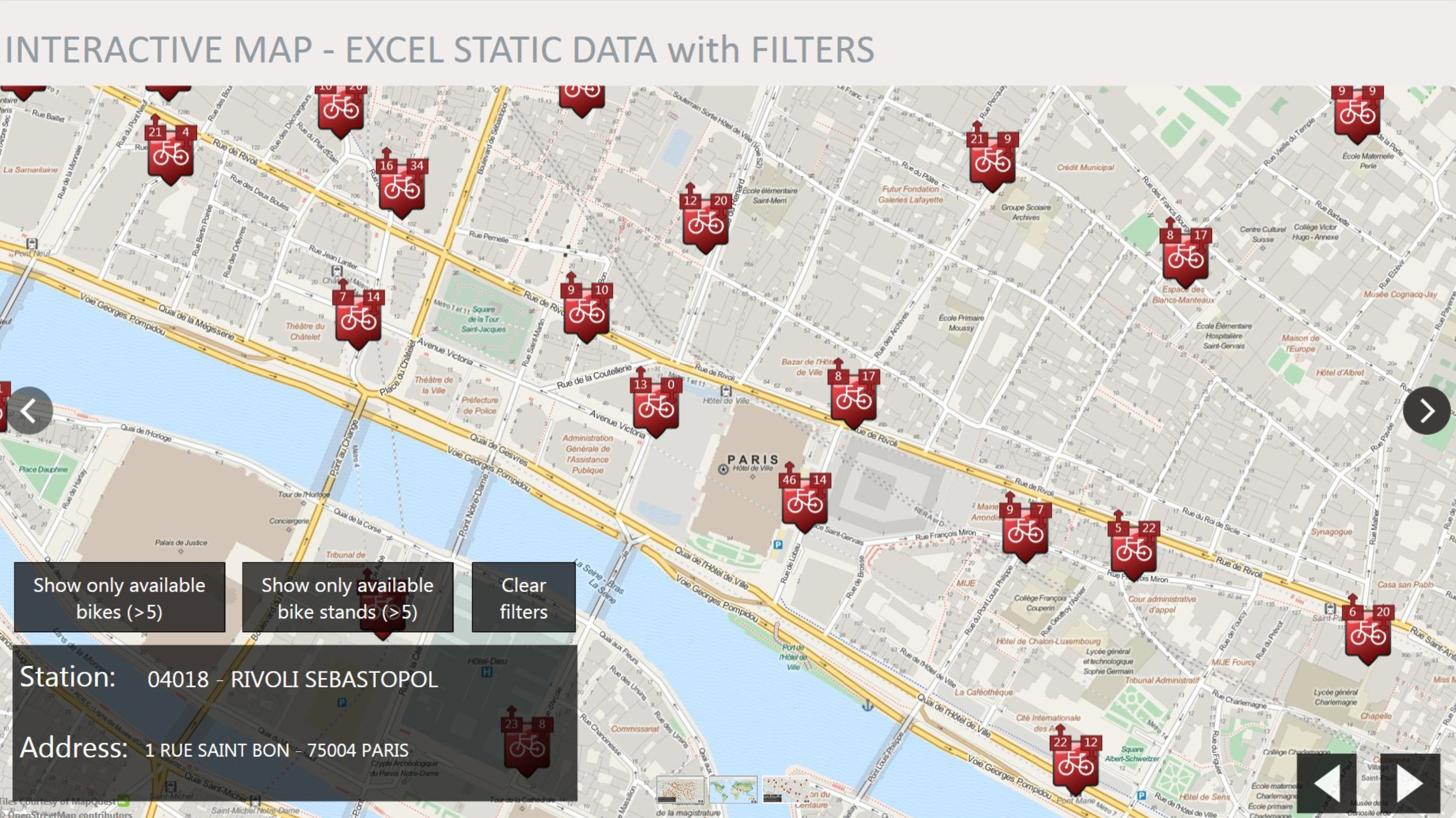
For a world map, we have a Map Interface Asset, it’s a type of collection where your items are positioned based on their latitude/longitude values.
You can see it in action in the free sample Interactive Maps (Data Visualization) from Marketplace.
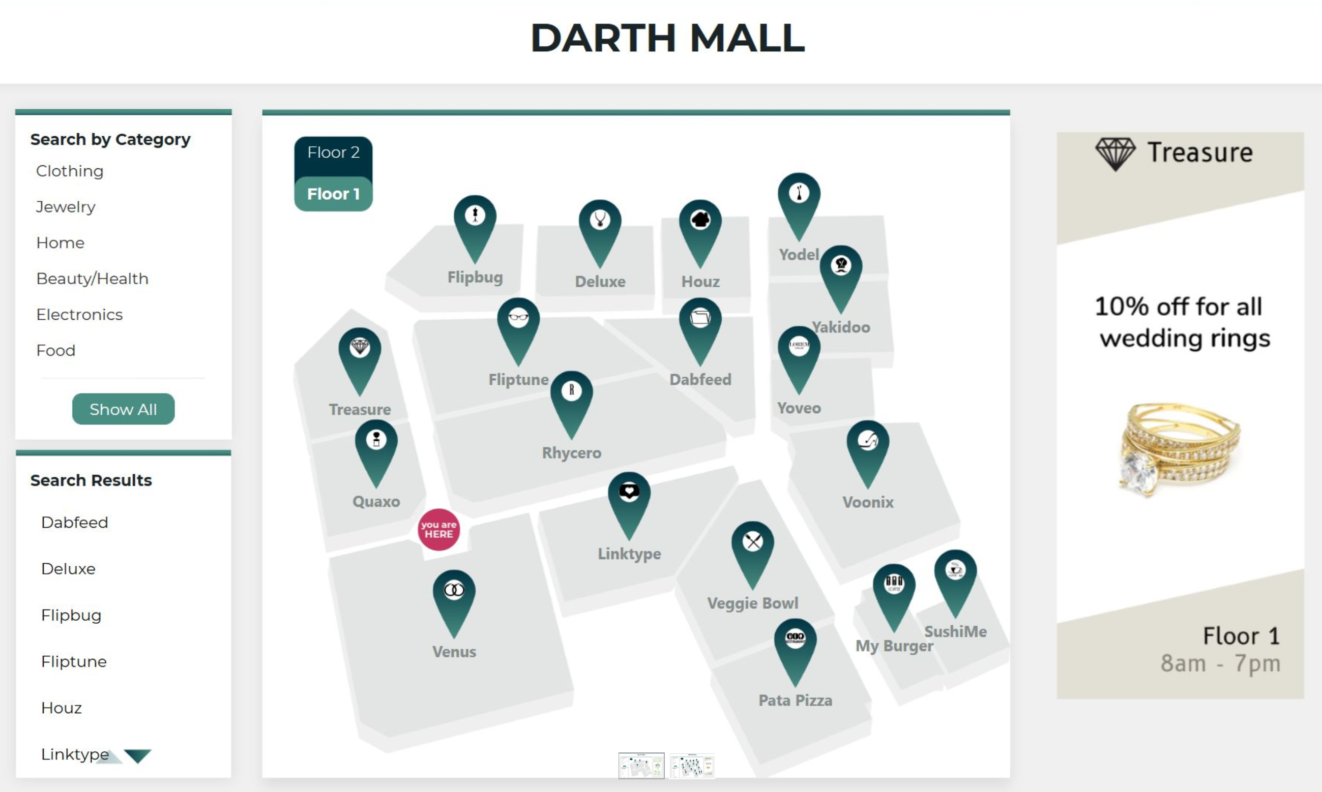
If you want an home made map, like an interior, a Group Collection will help, you can use bindings to position elements exactly where you want providing X/Y pixel values.
That’s what we do on the free sample Shopping Mall Wayfinder, don’t hesitate to download and test it.